Document Actions
Usecases
The LOCCATA project is developing a system for mobile terminals in order to send information in the form of texts, pictures, audios and videos. It is suitable for devices that are able to receive position data like Smart-Phones or PDA’s. With this, all kinds of information can be sent out at the right time. Tourism can offer new services using this system.
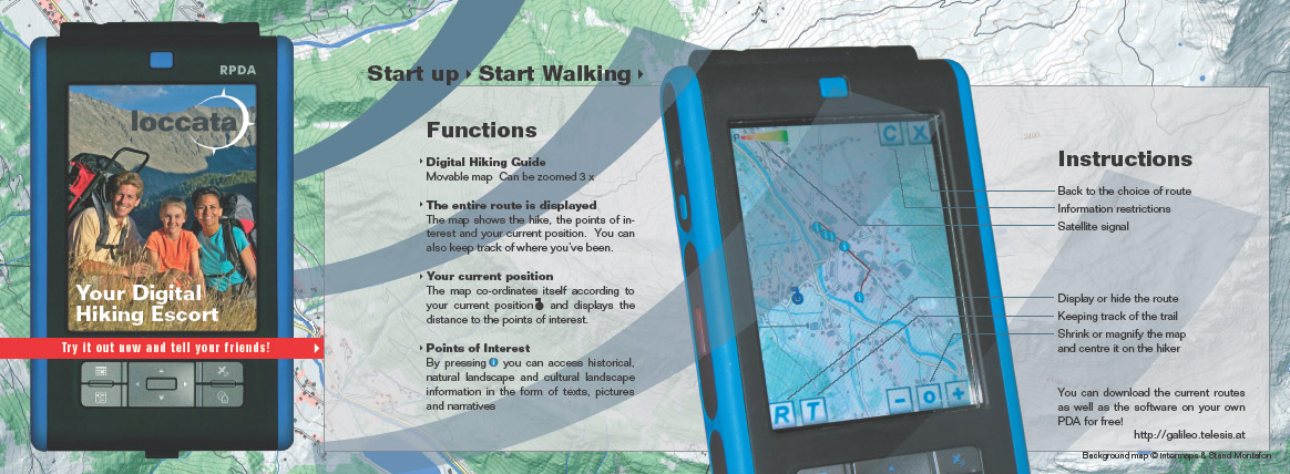
New ways to get information are waiting for the nature friend and hiker in the Montafon. Location based information about the landscape, history and culture can be recieved from Galileo satellites. The technology that was initiated by Telesis is based on the mobile telephone and the PDA both of which need to be connected to a GPS, or later ,Galileo receiver. If the hiker gets close to a point of interest (POI) his phone or PDA will draw his or her attention to it by vibration or an audio signal. The hiker can then access the location based information for the point of interest he is at. There are already 5 hiking trails with over 80 points of interest available and more are on the way!